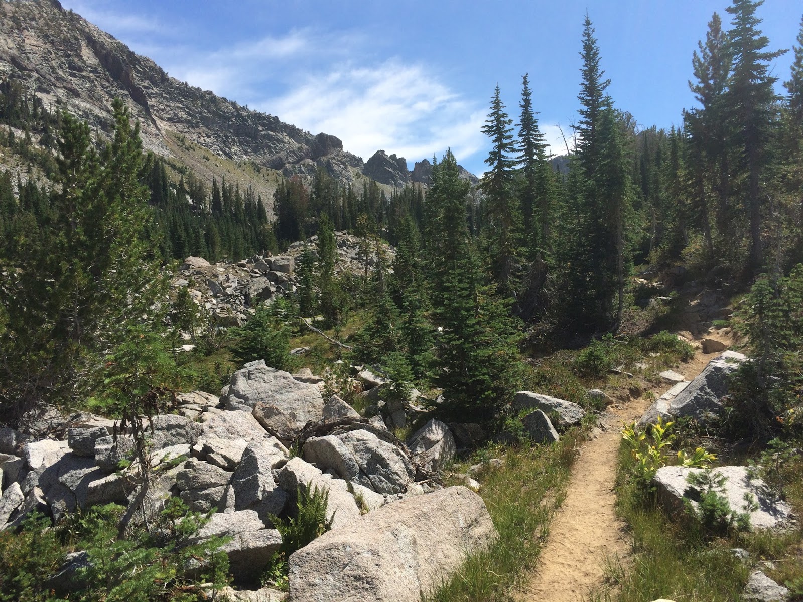
Wallawas, Oregon, GreenTrails maps, Amazing.
All totalled, Yessi and I hiked about 400 miles over two years in the Wallowas. They are a beautiful mountain range with amazing hiking. From the major highway they look simply like foothills and as you head up into them it's hard to imagine there will be steep granite cliffs, hidden valleys, snow covered peaks and pristine mountain lakes.
 |
| Yessi plans our mapping adventure. |
Yessi and I are now on our 5th year hiking for
GreenTrails maps. Every year we get sent to some place wonderful and every year where our only task is to find and hike the trails.
 |
| Yessi and dbBrad show off our GreenTrails hiking jerseys. |
How we start? We gather what maps we have, our camping gear, our GPS units and start driving. We head down initially hoping to find access, trail heads, resources and plan our outings. This usually takes a couple of days and then we start hiking. At some point we run out of time and return home to plan our next trip.
 |
| Somewhere in the Wallawas near Eagle Cap. |
In 2015, Yessi had to stay on Whidbey for work and so I went hiking with Ed and Benton. Ed did a couple of amazing hike with me including a 18 mile day that took us up over 6500' where we saw substantial snow on a beautiful July afternoon.
In 2016, yessi also had work and so I hiked with Ed supporting me and Benton on the trail. Thanks so much to both Ed and Benton for the support, the patience, the route finding nd the company.
 |
| Yessi in the Wallawas. |
While this may seem easy, quite often we are in places where the trails have been abandoned or are just so overgrown that we can't find them.
 |
| Yessi and Brad in the Wallawas |
Places where roads have overgrown to become trails.
 |
| This is one of those places where the trail is overgrown and or missing and you just have to wing it. |
Places where new roads have gone in disrupting the trails.
 |
In late july dbBrad, Ed and Benton encounter a snow storm up at 6500' in the Wallawas.
Somehow Benton managed to stay on the trail even though Ed and I couldn't see it. |
Places where fire has ravaged the land leaving no trees, no brush and no trails. In places like this, trails won't happen again until the landscape repairs itself and plants get large enough to warrant trail as well as to hold the trail. Without plants, its very difficult to define a trail.
 |
Benton, the worlds cutest Aussie, wondering why Ed and I are hiking so slow.
Benton carried a GPS this year and I wasn't surprised that he hiked twice as far as I did.
If you look at the back of GreenTrails Wallawa map, you will see Benton credited for his assistance! |
Places where the sale of property has let to the installation of locked gates restricting access to know trail heads shown on old maps.
 |
Brad and Benton get dumped on again in Late July. We saw
over 6" of snow this afternoon and couldn't wait to get down
below the freezing level. While we are seasoned hikers and were prepared,
one never expects quite this much snow in the middle of Summer. |
And sometimes you just can't find the trail because of the snow, new or old.
 |
| Brad and Benton loving life, just hours before it started snowing. |
Sometimes there are new trails. These are always a challenge too as we like to plan our trips to be as efficient as possible. When you're hiking and then you come across a trail that's not on your map, you have to follow it.
 |
Benton takes a break at a high point in the Wallawas. Again, there was no
trail here and the maps were totally wrong in this area so we had to wing it.
Fortunately we found a Kern at the top of the hill indicating we had found the trail again. |
In this case, the trail not being on the map is a total surprise. This is great but also a challenge as we can walk several miles to end up who knows where since it's not on the map!
 |
Benton and Brad followed an unmarked spur up a creek to the most amazing hidden Lake I've ever visited.
Because we were at the end of a 50 mile loop and out of food, our visit was short. |
Sometimes were erroneously follow a game trails. This year I missed a turn at a creek where the trail followed the topography around the mountain.
 |
| dbBrad and Benton high in the Wallawas. |
Having not seen the crossing and trail on the other side, I just kept walking. It was about 1500' vertical when I came to the top of a ridge that I wondered if I'd made a mistake.
 |
| A beautiful natural Meadow deep in the Wallawas. |
I thought I was headed into valley with a lake. When I checked my map, I saw I was indeed headed to a lake. So why was I climbing?
 |
| Yessi climbing over a tree in the trail. |
I've been to a lot of mountain lakes and a lot of ridges, but I've never seen a lake on a ridge.
 |
| Yessi and dbBrad high in the Wallawas carrying a balloon we found. |
Upon closer inspection of my topographical maps and my gps, I saw that I was indeed about 1500' higher than I was supposed to be.
 |
| Yessi and Brad climbing into a thunder/lightning storm and getting a little anxious at the lack of cover. |
So I turned around and went down, keeping a keen eye out for the trial I had missed.
 |
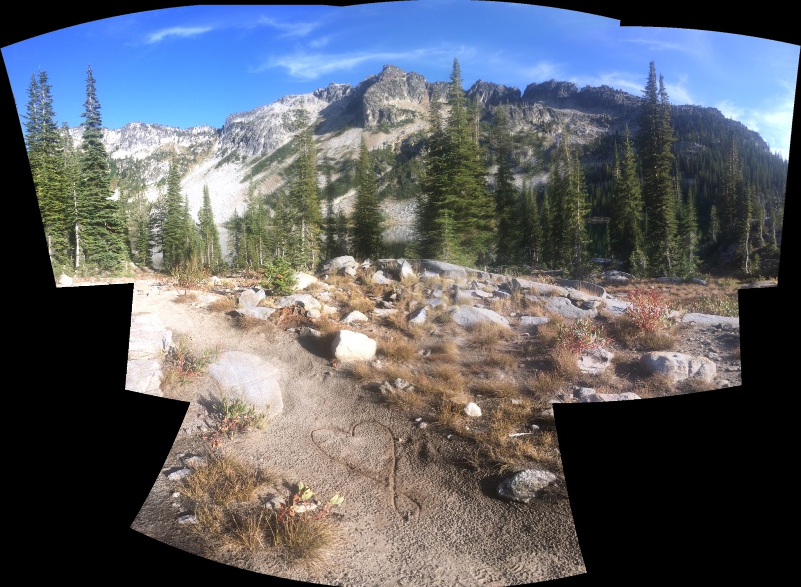
| Another HeartOnTheTrail by dbBrad. |
Believe my frustration when I reached a trail junction, one I had already mapped that was before the creek crossing.
 |
| One of the many wonderful lakes in the Wallawas. |
I had missed the trail twice now. This time I was 600' below my turn off and had to start climbing again!
 |
| Yessi, the worlds cutest hiker. |
At this point, when your 50 miles from your car, are relying on a trial to form a loop back and have failed to find a trail for a while, it's easy to get a little anxious. What if I cant find the trail and I have to turn around and go back? Do I have enough food? How will I get to the trails over there (otherside of missing trail) to map them? What if there is a trail and I miss it and then it doesn't get mapped? All these thoughts can add a bit of stress to what should be a totally stress free activity!
 |
Classic Wallawas with grass covered foothills, beautiful lakes and
rivers and snow covered peaks in the background.
|
I was able to find the trail and the creek crossing, finally, and resumed my mapping after hiking two more hours, a couple extra miles and almost 2k extra vertical.
 |
Yessi and I set up camp for the night. We like to Cowboy and sleep out
under the stars as much as possible. Leaving the tent in the car
is an easy way to drop 4 pounds. |
It turns out that because there are quite a few horses in the Wallowas. This with fallen trees which for the horses to cross the creek meant taking a different path. I followed the horses since it was where the dirt was torn up and looked like the trail.
 |
| Yessi and Heart Lake in the Wallawas. |
But following the horses across the creek left me with no trail to follow. It was the third time around after passing it twice, when I was finally able to find the 'real' trail on the other side of the creek.
 |
| Yessi in the Wallawas by one of the many wonderful lakes. |
This is so similar to many of the days we have hiking and mapping. But it makes for lots of fun, adds a bit of challenge and sometimes leads to the most wonderful lake or ridge or valley that I never would have gone too if not on assignment.
 |
dbBrad in the Wallawas at a hidden lake and meadow, one of the many
great surprises one can enjoy while hiking. |
These finds in life, the ones that are unexpected. When you just happen to stumble across the most amazing thing by accident or circumstance. These are truly some of my best memories, the ones that catch you by surprise
 |
| Benton, world's cutest Aussie and GreenTrails mapping expert. |
.